Smolensk warehouse
Geodetic survey of 49.49 hectares at 1:500 scale, with utility coordination. The case distinguishes this survey from the wider investigation project.
Full case study (Russian) →Real sites, measured quantities and excerpts from technical reports.
Geodetic survey of 49.49 hectares at 1:500 scale, with utility coordination. The case distinguishes this survey from the wider investigation project.
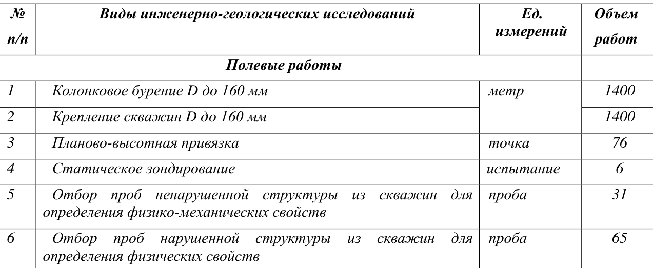
Full case study (Russian) →1,400 metres of drilling and six cone penetration tests. The 2025 report describes loose sands and groundwater observations.
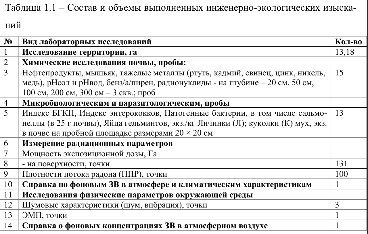
Full case study (Russian) →Land surveying over 15 hectares and environmental investigations over 13.18 hectares, including soil testing and radon measurements.
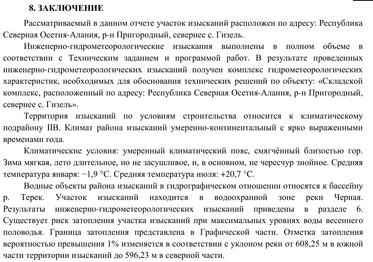
Full case study (Russian) →Topographic surveying of 130.26 hectares and hydrometeorological investigations identifying a flood risk associated with the Chernaya River.
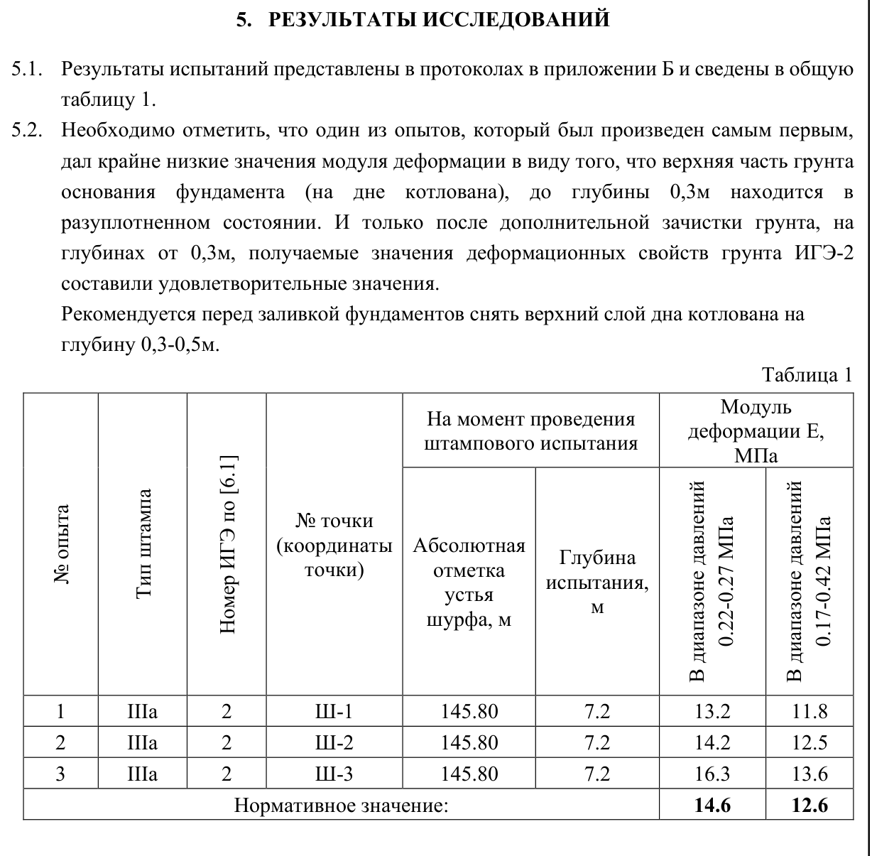
Full case study (Russian) →Plate load testing identified loosened soil at the bottom of the excavation. The report records the results after additional trimming of the base.
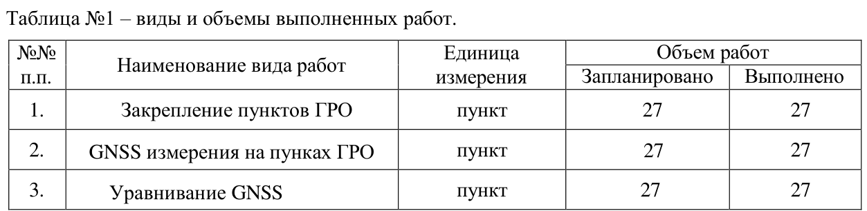
Full case study (Russian) →Topographic surveying of 78 hectares in 2024 and establishment of 27 geodetic control points in 2025. Separate reports document each scope.
Full case study (Russian) →Send the site location, a plan or a brief description. We will help define the scope, deliverables and price.